The trail, which I will describe as the first one in my blog is not so easy. It includes some muddy, steep and slippery places but most of it is simply a pure pleasure. I will point out in the description the areas that need special attention, but everyone who is going to run this path, does it at his own risk. I share this route with the readers of the blog Mammut On The Run since it is picturesque, varied and most importantly, little frequented. It passes through the northwest of Lausanne between Cheseaux-sur-Lausanne and Crissier where the river La Mèbre cuts a fabulous gorge in the sandstone rocks. With the suburban train LEB, the route is easily accessible from the center of Lausanne, from the initial station Lausanne-Flon. Stop where you need to get off is Bel-Air. Train timetable is available on http://www.leb.ch/.
Drivers can use the car park for guests at the Fondation de Vernand, Chemin de Praz-Lau 5, Cheseaux-sur Lausanne. Just remember not to occupy the parking spaces reserved for the foundation. It is a charitable organization, created in 1972. It looks after about 600 children and adults with intellectual disabilities and personality disorders.
Run to the end of the street Chemin de Praz-Lau in west direction, bypass the trash and utility room and on the gravel path next to the forest turn left. The trail leads to the south. After about 1 kilometer run through the clearing, where on the right hand side there is the forest tree nursery. Our road turns a slight curve to the right, back into the woods. When reach the yellow signposts Vaud Rando, turn right towards Crissier. The trail is marked with yellow diamonds.
There is a clearing with picnic and fire places a few meters to the right of our route. In the autumn and winter clearing is visible from our path while in spring and summer is covered with lush vegetation. In the clearing stands a monstrous stone – La Pierre à Cambot . It is a granite rock of alpine origin which was brought here by the Rhone glacier from the vicinity of Martigny about 25,000 years ago.
Run to an asphalt road Chemin de la Pierre à Cambot, turn right and after a few meters turn left into the path of the forest to the west. On the right, another forest tree nursery. Gravel road turns slowly to the right, due north. When get to the place where there are yellow arrows on the trees on the both sides of the road, turn left to a forest path and run down by the wooden steps. Just before the wooden bridge over the stream, turn right down according to the signs. By the wooden steps and footbridges Le trou de la Sorcière run down. Caution, slippery! I know what I write because it happened that I landed here on my butt. Carefully reach the bottom of the valley and by wooden bridge cross the river La Mèbre, which will be our companion until the end of the expedition. We leave for a moment the yellow trail. Here we ran about 2 kilometers from the start of the adventure.
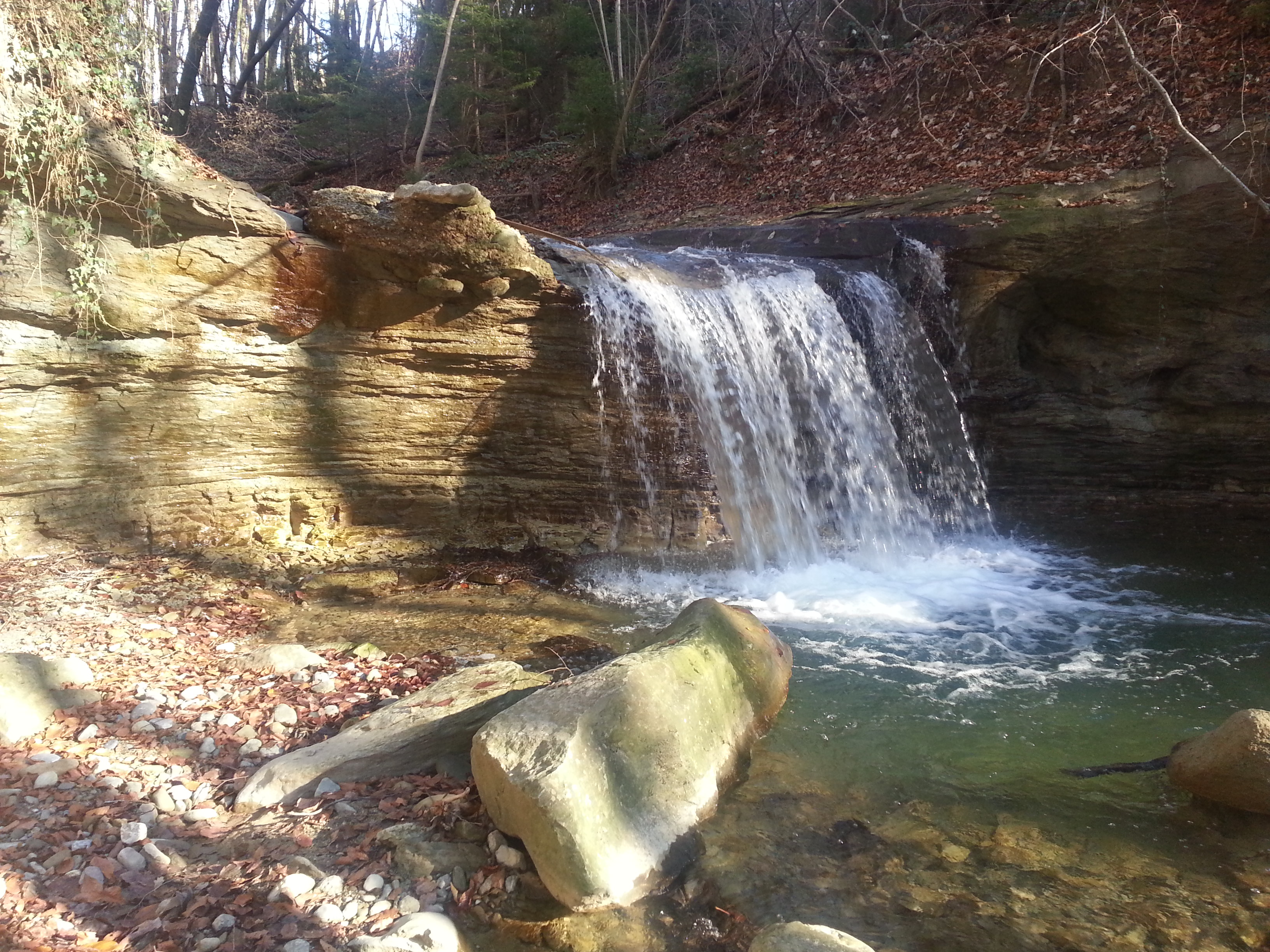
Behind the bridge slightly run up and turn left into poorly visible forest path along the river taking care to muddy and slippery places. This section requires a bit of intuition, because the path I trampled for you is not perfect yet. Run further having the river all the time on the left side untill the rock wall, which bypass from the left side, all the time with a stream below on the left. After a slightly muddy ascent reach the asphalt road Chemin du Devens and turn left, running down until about 3 kilometers from the start. On the traffic ban sign, there are again the yellow markings of the tourist path. There are also brown indicators Sentier de la Cascade which will help to find the way until the finish line. So, turn left, down to the forest, following the signs. The road is strewn with sawdust. Run to the fault rock and by the wooden steps reach the riverbed and the waterfall La Cascade de la Mèbre.
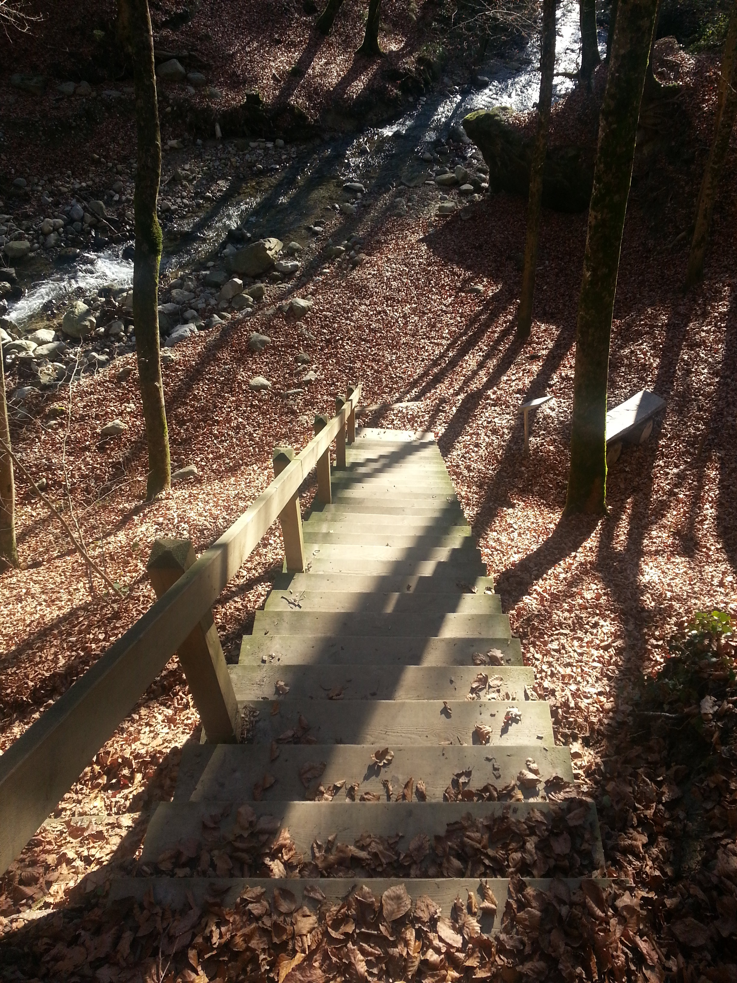
Stairway to the waterfall
You need to hurry up with a visit to this place, because the water of the river La Mèbre carries a large amount of sand that abrades the layers of rocks forming a waterfall. When the water will reach the softer layers of sandstone, erosion will accelerate and from the waterfall only a flat bed of the stream will remain.
La Cascade de la Mèbre
Continue farther due south along the river and run under the highway suspended on concrete pillars above the ravine. On the left side there are concrete water tanks. Interestingly, the river disappears underground for some time. The path leads still to the south. After a slight ascent cross the gate of rock and reach the next natural curiosity – La Pierre à Quatre Sous. Looking at the surrounding rocks and roots entwined around them, creating fancy supports, it is easy to understand the speed at which spalling of the sandstone occurs. From between surrounding boulders that us run out following the sharply path sprinkled with sawdust, and on top of the ascent turn left. The path rises and falls and about 4 kilometers from the start leads us by the next wooden bridge to the other side of the river La Mèbre.

To the other side
Just after the bridge, turn right and continue our trip along the river, which is this time on our right side. All the time we head down stream. At the next signpost continue to run by the Sentier de la Cascade, leaving a yellow trail twisting to the right. We arrive to the residuals of channels for fish farming and to the area of the old water mill (Le Moulin – Dessus). The first mention of this place appears in documents as early as 1337.
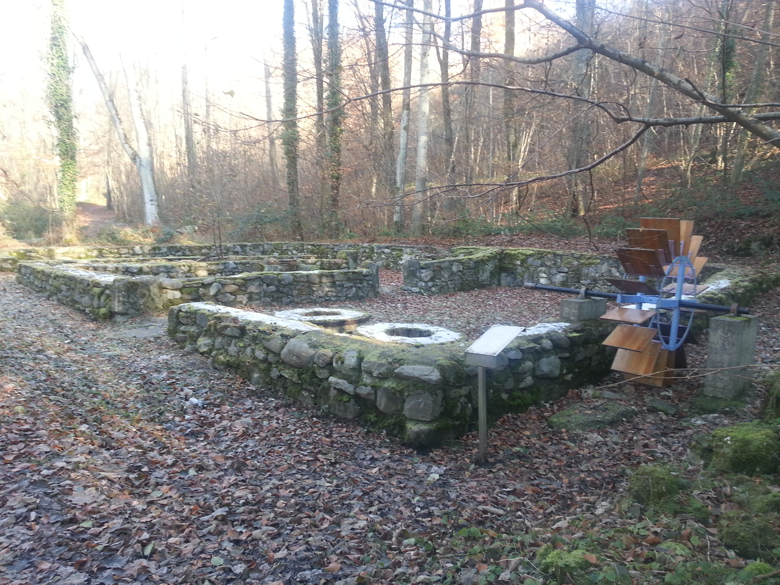
Le Moulin – Dessus
The route leads further down the river and at about 5 kilometer from the start, runs along the fence of the used cars’ parking, and then to a busy street Route de Prilly.
Route de Prilly
It is needed still to run to the right, toward Crissier to the bus number 18 (Bre) and back to the Flon where the expedition started for people traveling by public transport. A motorized and/or more motivated must follow their footsteps and reach the beginning of the route and take their vehicles or again use the green line LEB.
Below the trail recorded by GPS: